Black River Gorges National Park
Most of Mauritius’s remaining native forest is in the Black River Gorges National Park. Moreover, it is one of the most threatened floras, with less than 2% native forest left on the island. The National Parks and Conservation Services of Mauritius (Ref 1) were established in 1994 to manage the park. Home to over three hundred species of flowing plants and nine bird species.
The park has a visitor centre on the west side and an information centre on the east. It also has sixty kilometres of tracks through hilly forest and heathland together with some picnic areas. Most of the trails are point-to-point, except for the circular Mare Longue Loop, Macchabee Loop Forest and Macchabee-Colophanes. Trees shade the tracks, sometimes totally enclosing them, which helps with the temperature in a tropical climate. However, it detracts from the enjoyment as you only get a few panoramic views of the scenery. And, it can also be wet, as the average annual rainfall is about 100cm in the west to 400cm in the east.
There are four primary entrance points with car parks: Gorges Viewpoint, Alexandra Falls, Black River Visitor Centre, and Information Centre at Petrin. Also, the Park is on the UNESCO World Heritage Tentative List.
Black River Gorges Viewpoint and Alexandra Falls Scenic Drive
Scenic Drive: From Case Noyale on the west coast, drive to Chamarel, where the B103 Plaine Champagne Road run through the park. The road effectively cuts the park into two parts. Further, both Black River Gorges viewpoint and Alexandra Falls are on the Plaine Champagne plateau at around 700 m. Moreover, there are several scenic stops and trailheads such as the Gorges Viewpoint, Parakeet Trail and Alexandra Falls. After the falls, the road joins the B102, north to the Information Centre at Petrin and south towards the coast.
Black River Gorges Viewpoint
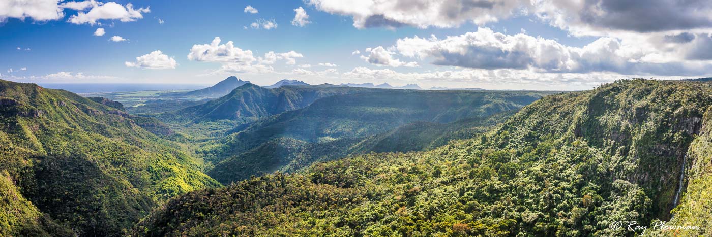
The viewpoint offers magnificent views of the gorges towards the mountains in the north and the west coast. It is also one of the best places to see white-tailed tropicbirds, as evident from my gallery photo below. Moreover, the Black River (Riviere Noire) and its tributaries run from the Plaine Champagne plateau northwest towards the sea. Near the viewpoint, the river cascades from the plateau to the valley below.
Black River Gorges National Park
Black River Gorges panorama from the viewpoint along the Plaine Champagne Road. The photo shows the west coast, gorges, mountains, and the Riviere Noire Cascade (Black River Falls) on the far right.
Black River Gorges Viewpoint Landscapes
[foogallery id=”17483″]
Black River Gorges Viewpoint
It is around 7 km from Chamarel along the B103 Plaine Champagne Road to the Black River Gorges Viewpoint. The featured photo shows the west coast, gorges, and mountains from the viewpoint. Next, a white-tailed tropicbird that was flying and finally the Riviere Noire Cascade.
To the right of the viewpoint, the Trochetia trail (Ref 2), enclosed by trees and shrubs, heads towards the Black River (Riviere Noire). I intended to walk to the river, but it was so muddy I gave up and returned.
Alexandra Falls
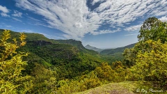
A short drive to the east of the Black River Gorges viewpoint is Alexandra Falls. Furthermore, there is a viewing platform allowing an elevated view of the cascade and panoramas of the south coast.
The Alexandra Falls trail is a strenuous path, down steep slopes to the cascade des Galets. This trail looked too tricky and slippery to walk. A wide easygoing track runs east to the B102 Chamouny to Vacoas-Phoenix/Curepipe road. About two-thirds along the route, the Mount Cocotte trail branches off. So, we opted for this more leisurely walk.
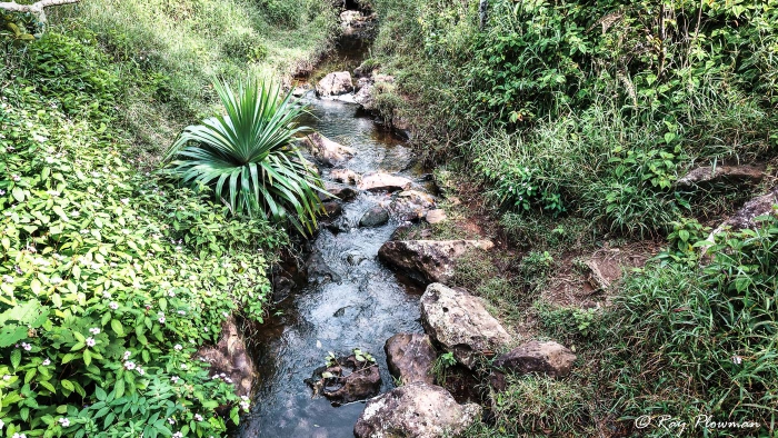
Riviere des Galets at Alexandra Falls
Alexandra Falls is on the Riviere des Galets, which flow south to the sea from the Plaine Champagne plateau.
Alexandra Falls Landscape and Wildlife
[foogallery id=”17484″]
Alexandra Falls
The first series of photos shows the falls and Riviere des Galets. Next is an image from Alexandra Falls viewpoint of the south coast town of Chamouny. Finally, pictures along the first part of the trail to Mount Cocotte and B102 Chamouny Road (Ref 3).
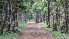
Moreover, the path makes for a pleasant walk, although trees and shrubs enclose some sections. Alas, there were no vistas, little wildlife, just a few attractive trees in the area we walked. However, I did spot an endemic blue-tailed day-gecko (Phelsuma cepediana) on an invasive traveller’s tree (Ravenala madagascariensis). These day-geckos are diurnal and arboreal, preferring smooth areas to rest and sunbathe, hence choosing this alien tree. Furthermore, the trees are endemic to Madagascar and belong to the Strelitziaceae family. The gallery also features a photo of the lowering traveller’s tree where the gecko was sunbathing.
Trails from Black River Visitor Centre
The Black River Visitor Centre is a short drive along the Les Gorges Road from Grande Revere Noire village on the west coast. Features photography from several walks, including the Macchabee, Parakeet and Mare aux Joncs Trails.
Trails from Petrin Information Centre
Petrin Information Centre is opposite the junction of the Grand Bassin Road and the north-south B102 road from Chamouny to Vacoas-Phoenix/Curepipe. Photo album displays flora, fauna and landscape photos taken while walking the Macchabee Trail.
References and Bibliography – Online Resources
1. National Parks and Conservation Services. 2020. [Online] Available from National Parks and Conservation Services [Accessed 28-Oct-21].
2. Gorges Viewpoint. No date. [Online] Available from Mapcarta [Accessed 28-Oct-21].
3. Alexandra Falls. No date. [Online] Available from Mapcarta [Accessed 28-Oct-21].
4. The Open Map. No date. [Online] Available from Mapcarta [Accessed 28-Oct-21].
5. All Trails – Alexandra Falls Trail. 2021. [Online] Available from All Trails [Accessed 28-Oct-21].